Project Meganom consortium to design Moscow River-adjacent urban development
By Bustler Editors|
Friday, Dec 26, 2014

Related
The consortium led by Russian architecture firm Project Meganom has the winning design concept for the urban developments planned for the Moscow River's adjacent territories. The winning team includes Gillespies (UK); Strategy Partners Group (Russia); John Thompson and Partners (UK); Systematica (Italy); and Cushman & Wakefield (Russia).
The competition began with 47 consortiums (216 companies) from 15 countries which was then narrowed down to six. A final version of the winning concept will be presented in April 2015.
Scroll down to see the proposal.
Project description:
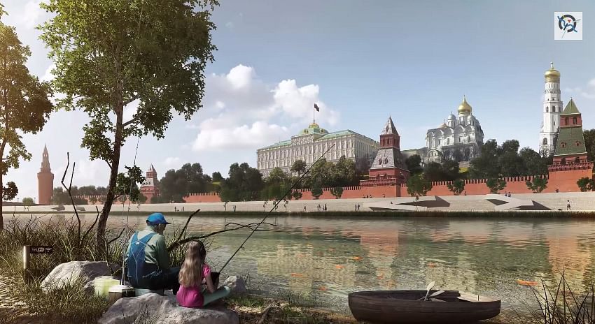
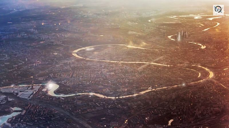
"Project ideology: Generalized port image served as a concept reference point. Concept foresees attractive cultural and recreational space on the water - magnets and 'transfer points', built into elaborate system of pedestrian and transport links, support functions, advanced environmental technologies and programs of urban partnership. Each port has a unique identity as a gateway to the surrounding areas. Port and its dense system of spaces in the city create a new axis of Moscow development. Network of river parks as the future structure of the Greater Moscow.
The concept implementation plan includes three strategic areas:
- intensification acupuncture new river portals
- intensifying links: human scale for system development
- healthy ecosystem and smart cleaning system
There is also a proposal for a 'Naturalization of Moscow River', to create a naturalized edge to the north embankment (or the part of the city) and a number of ecological islands, directed into the southern side of the river bank."

"Transportation
The project proposes:
- First of all, to develop public transport infrastructure: metro, new bus and tram routes, and water transport;
- Develop walking and cycling infrastructure under and on the river and on the way to the river;
- Turn river embankments in public spaces;
- Create ports, which will become agents of the urban environment and will serve as means of river transportation.
The project offers a number of integrated transport solutions:
- Improving connectivity of private transport by the reorganization of road space;
- The introduction of high-capacity transport systems
- Creating active corridors to facilitate pedestrian and bicycle links as the main mode of transport;
- The creation of water transport for linking zones not connected with each other directly. Creating a water tourist route, the ferry route and high-speed water transport routes.
- Development of public transportation."
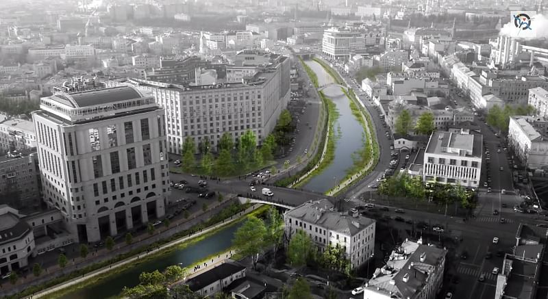
"Linear territories: The concept of developing connection between the three rivers of Moscow is based on the initiative to create an integrated cultural, recreational and tourism program of the coastal territory. A large number of iconic objects are located in the areas of walking distance of the Moskva River. Communication of coastal areas of three rivers - Setun, Moscow and Yauza has great potential for the development of large programs in the city aimed at uniting the urban space and finding new areas of attraction. The concept of gardening the river involves the creation of a certain living space for communication and creativity, education and cultural activities.
Along the north bank of the Moscow River there are special green islands for water purification. This is a filtration system of surface drainage: water enters the lagoon between the water breakers and is cleaned, bypassing the island. The embankment with natural beaches gives a live view to the city. Green Islands are the places where city inhabitants can touch nature. The Vodootvodny channel embankment gained wide natural promenade lying on the green carpet, beautifully drawn-out on the surface of the water. This carpet is both boulevard and square, and a natural corridor within the urbanized landscape. Special plants filter the water and surface drainage, while enlivening the stone heart of the city and creating an opportunity for people to feel the closeness of nature."

"Stroginskaya Floodplain: The project includes the creation of a new sports and recreation magnet based on six different zones, each with a unique 'green building', which will demonstrate sustained architecture of Russia and uniqueness of each place. All areas are connected by the Sport lake with regular water transportation. Sports Park is the most popular area of the site, and is located near the Strogino district. The park, which is the main pedestrian gate to the lake, can be reached in 8 min on foot using the updated pedestrian boulevard. Sports complex with free of charge entry and service-based fees offers a variety of sports facilities.
Mnevniki. Parliamentary Gardens: The project proposes to preserve the maximum of northern edge of the island for a modern iconic building that will serve as a gateway to the system of 10 parks and gardens. All natural areas will have their own identity and character, and will become a permanent destination for residents and future local residents. Together with the Parliamentary complex there will be a monumental public square, which will hide the underground metro line and public parking. Port 'Parliamentary Gardens' will be located on the water near the square, and will be the main shopping and event location on the island. The main residential area of Mnevniki will be located around future metro station in the southern part of the island, and will serve as a sample of the 'ideal city', promoting walking and cycling, and limiting car usage."

"ZIL: The main approach is more far-reaching coverage of ZIL territories, with the identification of the three principal axes. Each of them will be pedestrian and enriched with the most functions. But the axis will have different focus: culture, innovations, entertainment. Three main areas will converge at the tip of the peninsula, where the iconic public building - Planet ZIL will be located. The first axis, area 'Z', is a highly dynamic composition of architectural forms and activities, which will mix commercial and cultural functions. Walking axis is represented by the 'stage' with continuous events and a rich cultural program, which will connect the local business and its operators.
The second axis, the 'I' area, will be an innovative hub, combining large offices for research and development companies on the one hand and mixed small offices for start-ups, on the other hand. The third axis, the area 'L' is structured around the existing backwater. Using the model of the successful renovation of the HafenCity in Hamburg area, 'A' will be characterized by arranging a variety of cafés, restaurants and entertainment facilities on the one hand and a more relaxed waterfront residential area with houses hanging over the water on the other."

Share
0 Comments
Comment as :