The inaugural DENCITY winners explore ideas that address global lack of shelter
By Bustler Editors|
Monday, Jul 13, 2015
Related
As many of us are already aware of, the world's cities are grappling to adapt to rapid urbanization and population growth, which is forcing too many inhabitants to deal with substandard living conditions. To bring attention to this ongoing challenge, Shelter established the inaugural DENCITY competition.
Architects, designers, planners, and organizations worldwide were invited to submit their ideas on how to handle and alleviate urban density of unplanned cities, with no restrictions to site, program, or size. The first run of the competition had a solid start with a total of 300 registrations from 50 countries. In the end, the jury selected three winners and six special mentions.
Have a look at the winning entries below.
1ST PLACE ($1,500): Urukundo: Slum Factory
by Robert Elkins, Riccardo Valsesia, Lucia Fanetti Zamboni
Project introduction: "Rwanda in recent years is experiencing a surge in population growth. This is mainly concentrated in large towns and cities such as Kigali, its capital, which has become the center of a strong migration from a population once almost exclusively rural. Over the past 50 years its population increased a hundredfold. Environmental degradation, uncontrolled deforestation, exploitation of wetlands for residential, industrial and agricultural purposes are just some of the effects of this unplanned expansion."
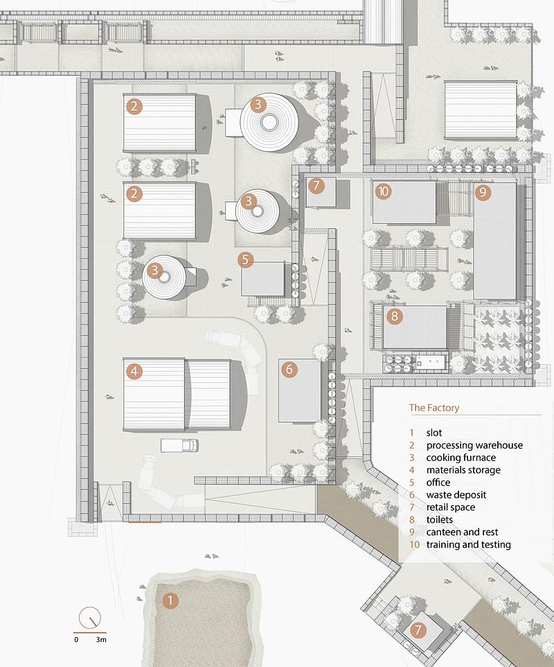
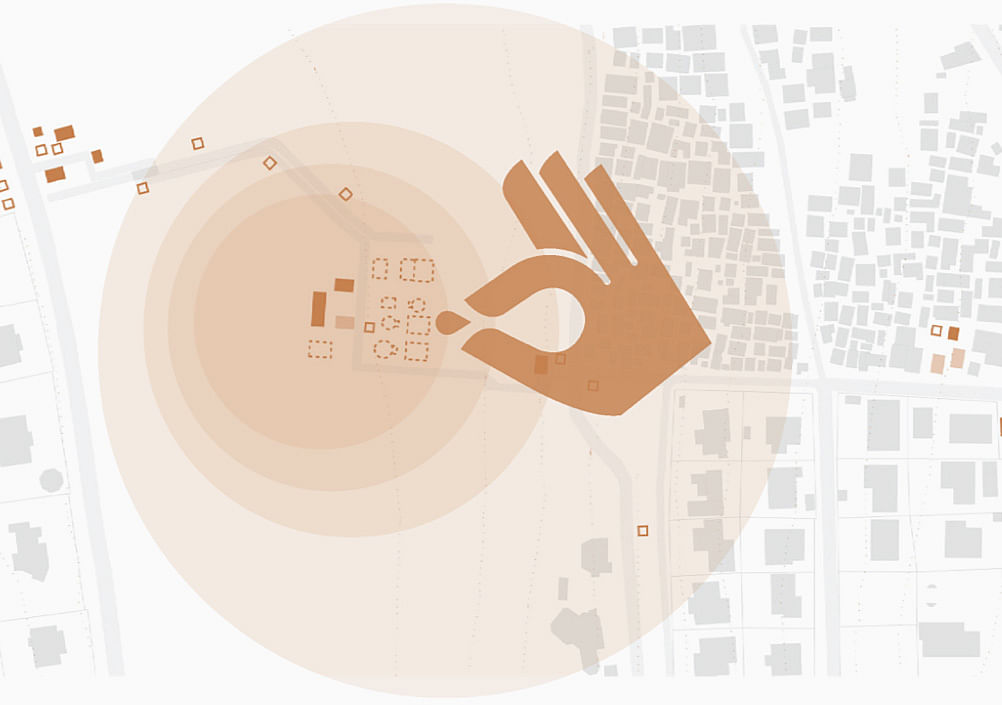
"The project focuses on an informal neighborhood, located in the north hills of Kigali, particularly affected by these changes. On top of the hill there are newly constructed governmental and institutional buildings. Those activities attract a lot of speculative interests in the area that, by embracing the desire to “clean up” and enhance the city’s image, apply a strong pressure for change. Consequently part of the existing neighborhood has already been demolished and partially replaced by high-priced private houses."

RELATED NEWS 2015 Laka Competition winners interpret "Architecture that Reacts"
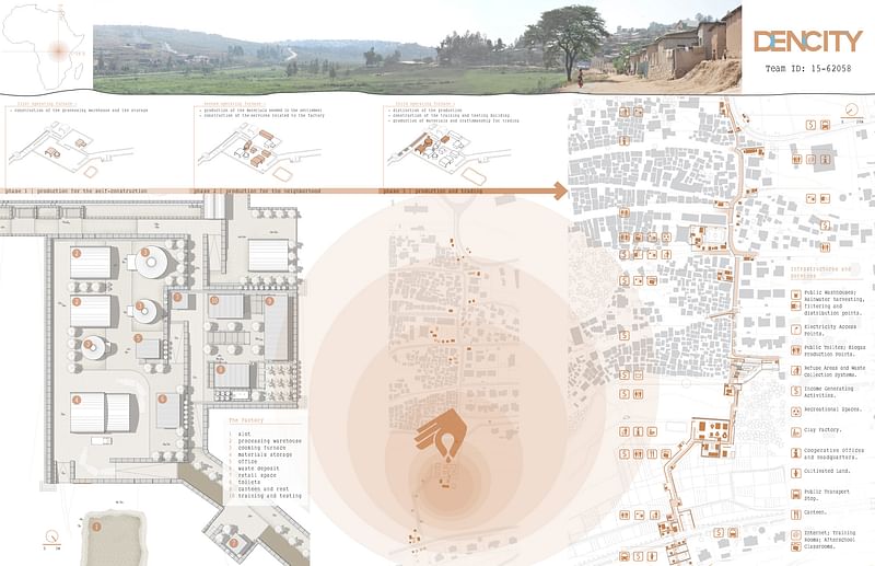
"However, the area is lively and has been occupied for more than one hundred years by the informal settlement of Urukundo, whose 3400 inhabitants’ lives are strongly linked to the territory. At the bottom of the hill, the area is currently enriched by a small clay cooperative in which some or the inhabitants work."
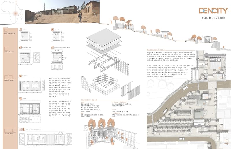
"At present the services and infrastructures are fragmented and therefore impractical or unused. In addition they unevenly reach the population of the area, creating huge discrepancies between the inhabitants. The open-air gathering spaces, the playgrounds and green areas are fragmented and often not separated from the dirt roads and therefore dangerous. The vegetation is sporadic and not suitable for the containment of the soil in order to avoid fluvial erosion. Further the accessibility to some parts of the neighborhood is very problematic and the movement along the main road network is made even more difficult by the yearly erosion in the rainy season."
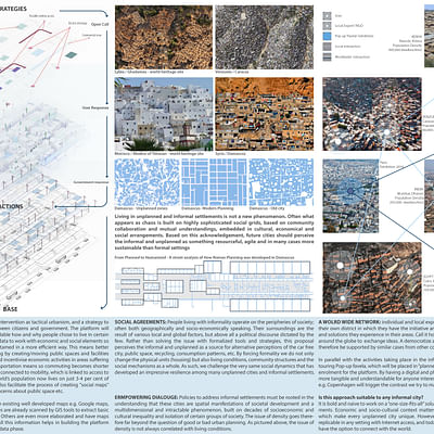
2ND PLACE ($600): The Agency of Mapping: Social Empowerment in Rio de Janeiro
by Jack Isles

Project introduction: "It can no longer be said the internet has no form… today and tomorrow it is a weapon of marginalization, whose figure can be seen in the shadows of urbanization. As our cities become crowded, there are those that exist outside of our technological infrastructures, those who are exempt from our own global networks of communications"
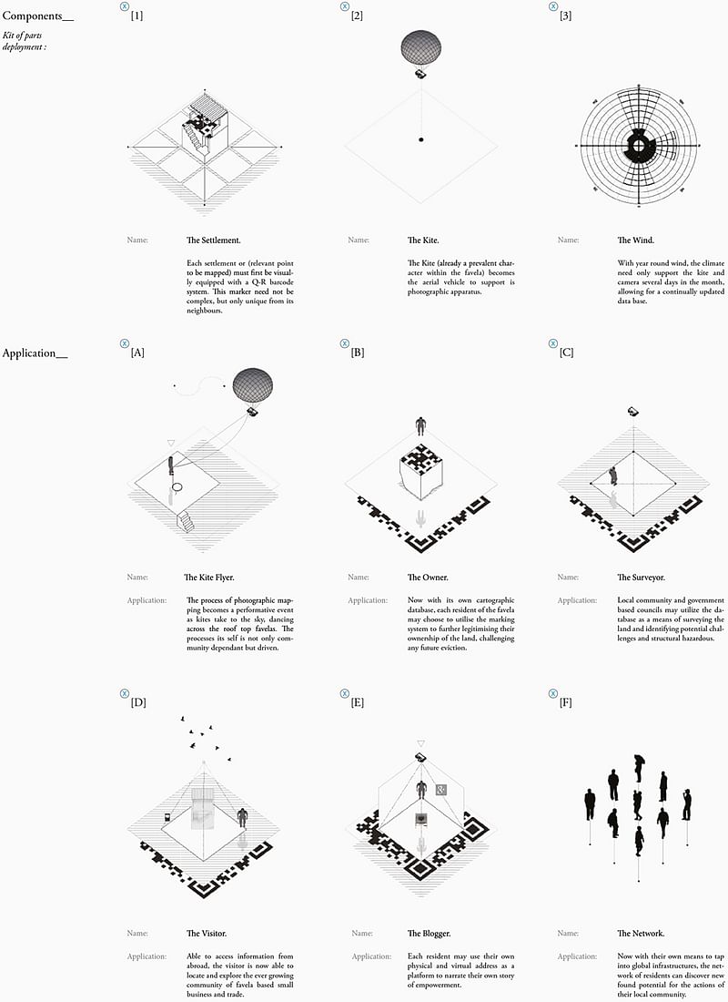
"The occupants of our world’s densest cities too often live without a voice, silent amongst the chorus of political discourse. Unmapped and unchartered, the informal settlements of our cities too often lie dis-empowered, misunderstood and miss-represented."
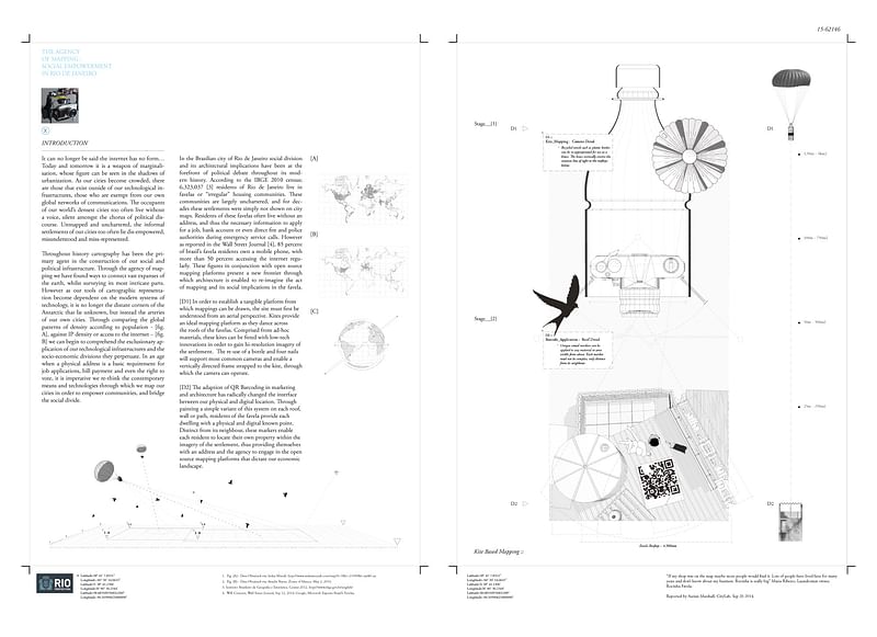
"Throughout history cartography has been the primary agent in the construction of our social and political infrastructure. Through the agency of mapping we have found ways to connect vast expanses of the earth, whilst surveying its most intricate parts. However as our tools of cartographic representation become dependent on the modern systems of technology, it is no longer the distant corners of the Antarctic that lie unknown, but instead the arteries of our own cities."
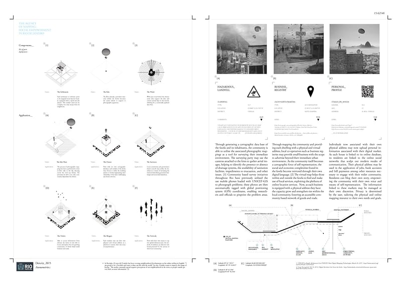
"Through comparing the global patterns of density according to population, against IP density or access to the internet, we can begin to comprehend the exclusionary application of our technological infrastructures and the socio-economic divisions they perpetuate. In an age when a physical address is a basic requirement for job applications, bill payment and even the right to vote, it is imperative we re-think the contemporary means and technologies through which we map our cities in order to empower communities, and bridge the social divide."
3RD PLACE ($300): Agua Común-ity: Common Water
by Han Kwon, Kellen Pacheco
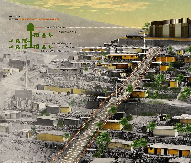
Project introduction: "Agua Común-ity seeks to address both access and efficiency of water infrastructure, which in turn gives form to private greenscapes and becomes social class identifiers in the municipality of Manchay in Lima, Perú. Manchay, similar to other informal settlements in Lima, was settled via mass migration and land invasions in the 1980s by people driven from their rural villages and poor urban districts because of political conflict – referred to as the years of terrorism in Perú."

"It was in the 1980s that the Communist Party of Perú, Sendero Luminoso (Shinig Path), a Maoist rebel organization, began ‘campaigning’ throughout rural villages in the Andes, gaining control of the villages and districts they passed through with violence and intimidation. As a result of this rebellion, indigenous peoples from the central and southern Andes were forced to migrate from the lush green landscape of the mountains to the hot sandy landscape of Manchay. This drastic contrast in change of environment undoubtedly had some level of psychological impact on these people – what was once green, fruitful, and lively outside their home, is now barren and sandy."
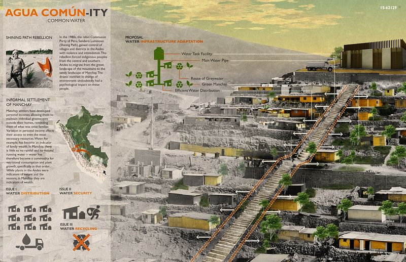
"In the past decade or so, the Manchay settlers have developed local economies and incomes allowing them to construct and sustain their own individual greenscapes outside their homes, reminding them of what was once so familiar. But, as the economy of each family began to vary, so did their access to even the most necessary resources. For example, access to water has now become an indicator of family wealth. Water in the Andes was a common resource due to its natural abundance, but in Manchay, the bottom-line is that there is no water and water has therefore become a commodity serving two purposes, nutritional consumption and plant growth, specifically in that order."
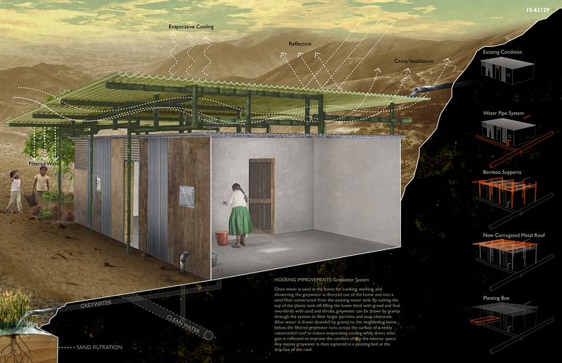
"Families who are able to satisfy all their nutritional water consumption in excess, can then grow plantings with their surplus of water; those who can only satisfy their families’ nutritional water consumption do not waste water on plants. While plants in the Andes were indicators of nature and the seasons, they are now symbols and indicators of wealth in Manchay."
For the Special Mentions, click through the thumbnail gallery below. You can read more about each of them here.


Share
0 Comments
Comment as :